Application Description
Effortlessly manage KML/KMZ/GPX files with MAPinr, a robust GIS tool that also offers measuring capabilities, GPS logging, WMS support, and offline maps. Designed for both professional and recreational use, MAPinr caters to activities such as hiking, cycling, running, and skiing.
Thank you for choosing Mapinr. The rapid evolution of Android versions presents challenges for non-profit projects like ours. However, we are committed to keeping this project alive and aligned with our mission to provide a secure, privacy-friendly, and affordable app.
We understand that Google Play requires a minimum Android version that not all devices can support. To address this, we offer downloads for older Android versions (below Android 14) directly on our website, as these are no longer available on the Play Store.
Are you interested in managing your own points of interest or looking to pin your photos on a map? MAPinr is a straightforward, ad-free Android app that enables you to handle your kml/kmz files and showcase your gpx files on various maps. It's ideal for both professional and leisure activities like hiking, cycling, running, and skiing.
Your feedback is invaluable to us. Please share your issues and suggestions for improving MAPinr by emailing us at [email protected]. We appreciate constructive feedback and understand the frustration that can come with software bugs. Please remain patient as our resources are limited, and we can't implement all suggestions immediately.
MAPinr offers a range of features to enhance your mapping experience:
- Ad-Free Experience: Enjoy an app without any ads.
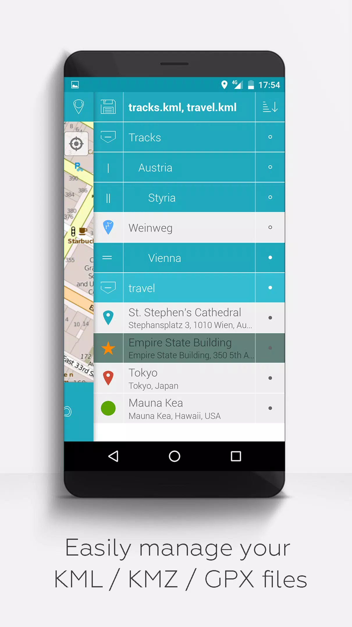
- Organized File Management: Use a hierarchical folder structure to manage multiple kml/kmz/gpx files.
- Comprehensive KML/KMZ Handling: Create, load, edit, save, import, export, and share kml/kmz files.
- Versatile GIS Features: Create, load, edit, save, import, export, and share waypoints, lines/tracks, and polygons.
- Photomaps: Add pictures to your waypoints to create engaging photomaps.
- Map Variety: Display waypoints, lines/tracks, and polygons on diverse maps including Maps, Satellite, Hybrid, OpenStreetMap, Opentopomap, and Opencyclemap.
- Share Your Location: Easily share the coordinates of your waypoints.
- Customization: Individually colorize waypoints, lines/tracks, and polygons.
- Interoperability: Open exported kml/kmz files in other apps.
- Efficient Search: Search by name, address, and coordinates.
- Location Sharing: Share your real-time location with friends.
- Simultaneous Display: View multiple kml/kmz/gpx files at once.
- File Merging: Merge kml/kmz files for streamlined management.
- Cloud Integration: Seamlessly integrate with cloud services.
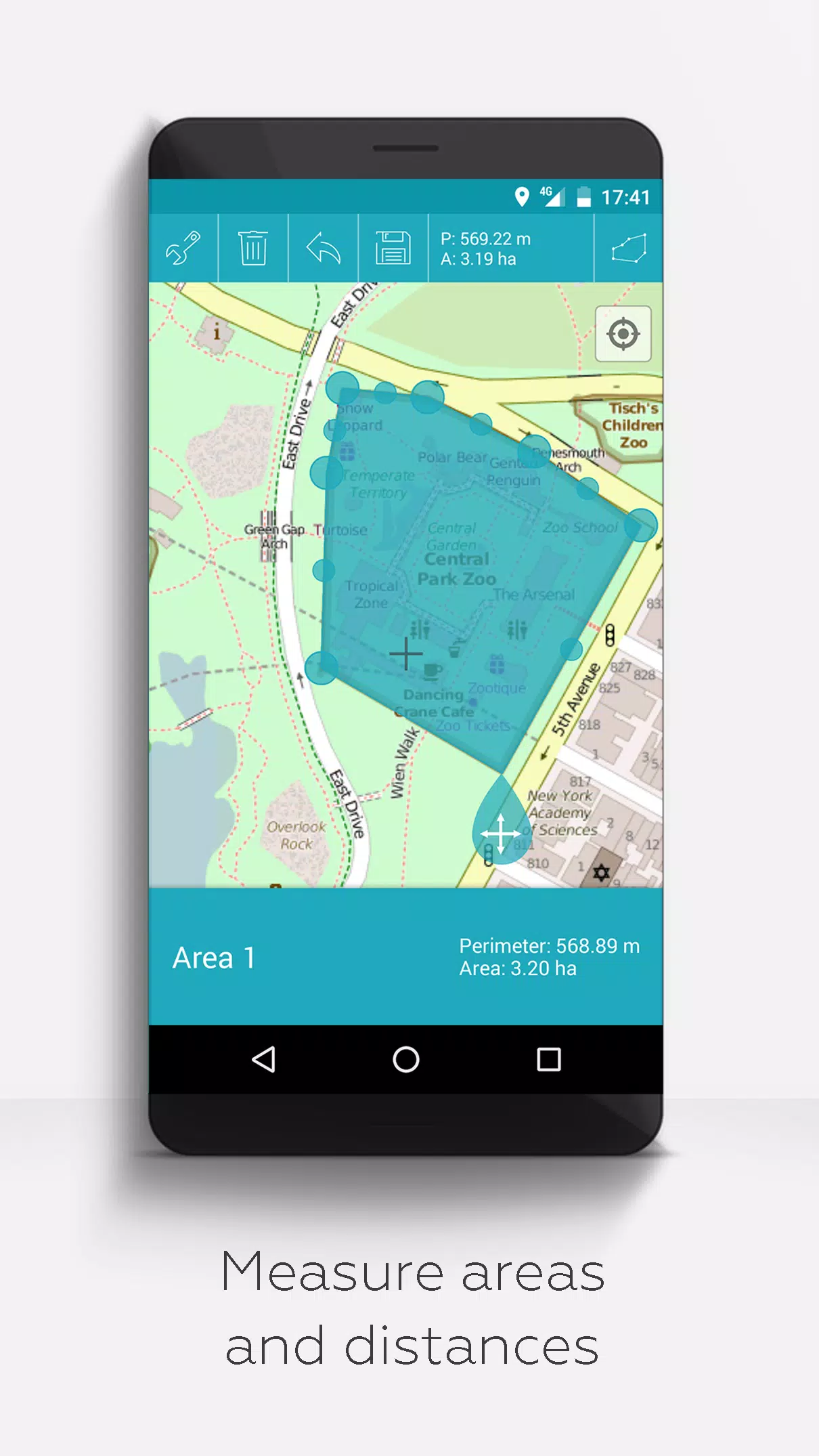
- Measurement Tools: Measure distances and areas directly on your map.
- Multilingual Support: Available in English, Spanish, Lithuanian, and Polish.
Extended features are available for free with donations or a LinkedIn like, and can be activated in the app's settings:
- Offline Maps: Download maps for offline use from OpenStreetMap.
- GPX Viewer: Display GPX files.
- WMS Support: View arbitrary map data using Web Map Service, such as Opendata from www.data.gov.
- Custom Metadata: Create custom metadata for your files.
- Custom Icons: Upload and use your own icons.
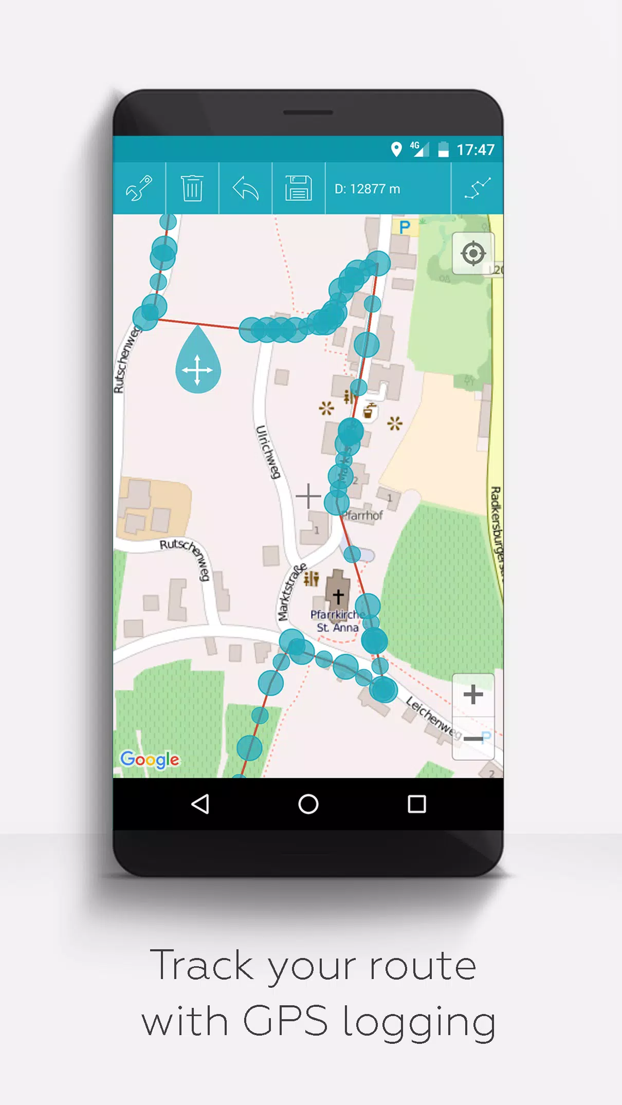
- GPS Tracking: Record GPS tracks during your activities.
Unlike similar apps, MAPinr respects your privacy and does not collect or sell your data. Donations are a voluntary way to support our non-profit efforts.
Screenshot
Reviews
Apps like MAPinr - KML/KMZ/OFFLINE/GIS


Trending apps


Top News


Latest Apps


Latest Articles