Application Description
Transform your smartphone into a robust off-road GPS navigator with offline topographic maps!
No ads ~ No data sharing or monetization ~ No analytics ~ No third-party libraries
AlpineQuest is the ultimate tool for all your outdoor adventures and sports, encompassing activities like hiking, running, trailing, hunting, sailing, geocaching, and off-road navigation among others.
You can access and store a vast array of online topographic maps locally, ensuring they are available even when you're out of cell service range. Additionally, AlpineQuest supports numerous on-board file-based raster map formats.
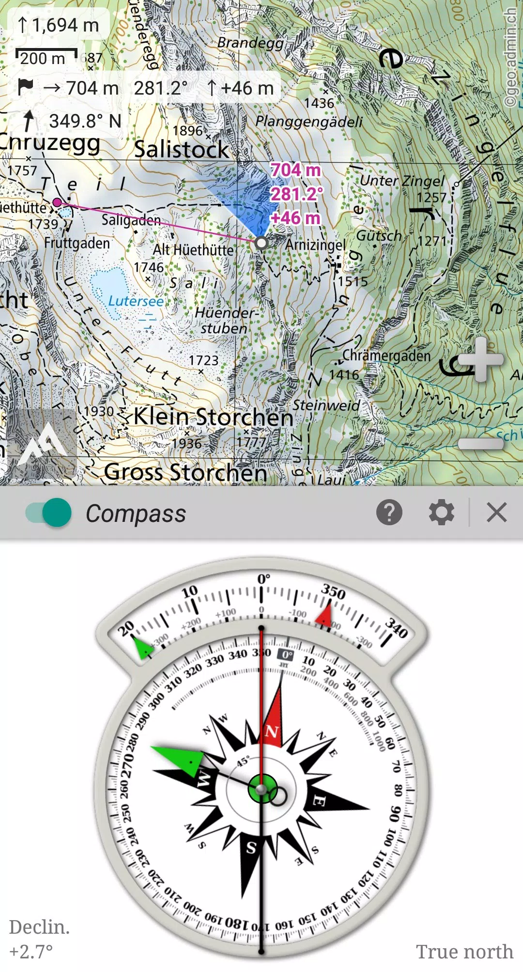
Leveraging your device's GPS and magnetic sensor, combined with a compass display, AlpineQuest ensures you never lose your way. You'll be localized in real-time on the map, which can also be oriented to align with your current view.
Save and retrieve an unlimited number of placemarks, and share them with friends. Track your routes, access advanced statistics, and view interactive graphics to enhance your outdoor experience.
AlpineQuest remains fully functional without cell coverage, making it perfect for exploring remote wilderness areas.
Try the Lite version for free today!
For suggestions and to report issues, please use our dedicated forum at https://www.alpinequest.net/forum (no registration required, all questions answered) instead of leaving comments.
Key features include (available in the full version):
★★ Maps ★★
• Access built-in online maps with automatic local storage, including road, topo, and satellite maps, along with online layers such as road names, hillshade, and contours.
• Easily access more online maps and layers from our community maps list, covering major worldwide and local topo maps.
• Store entire map areas for offline use.
• Support for on-board offline maps (raster) including KMZ Overlays, OziExplorer OZFx2, OZFx3 (partial), calibrated images, GeoTiff, GeoPackage GeoPkg, MbTile, SqliteDB, and TMS zipped tiles. Visit our website to download MOBAC, the free map creator.
• Support for QuickChart Memory Maps (.qct maps only, .qc3 maps not compatible).
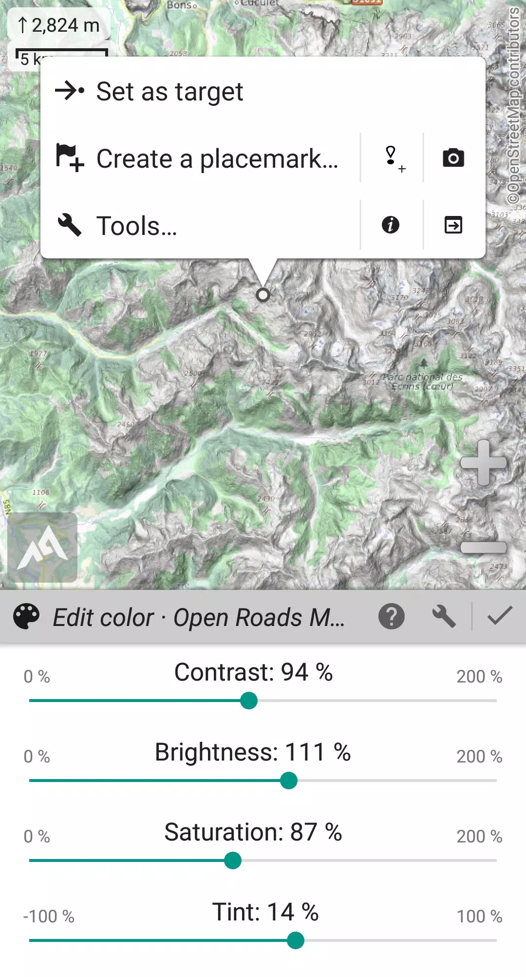
• Built-in image calibration tool to transform any scan or picture into a usable map.
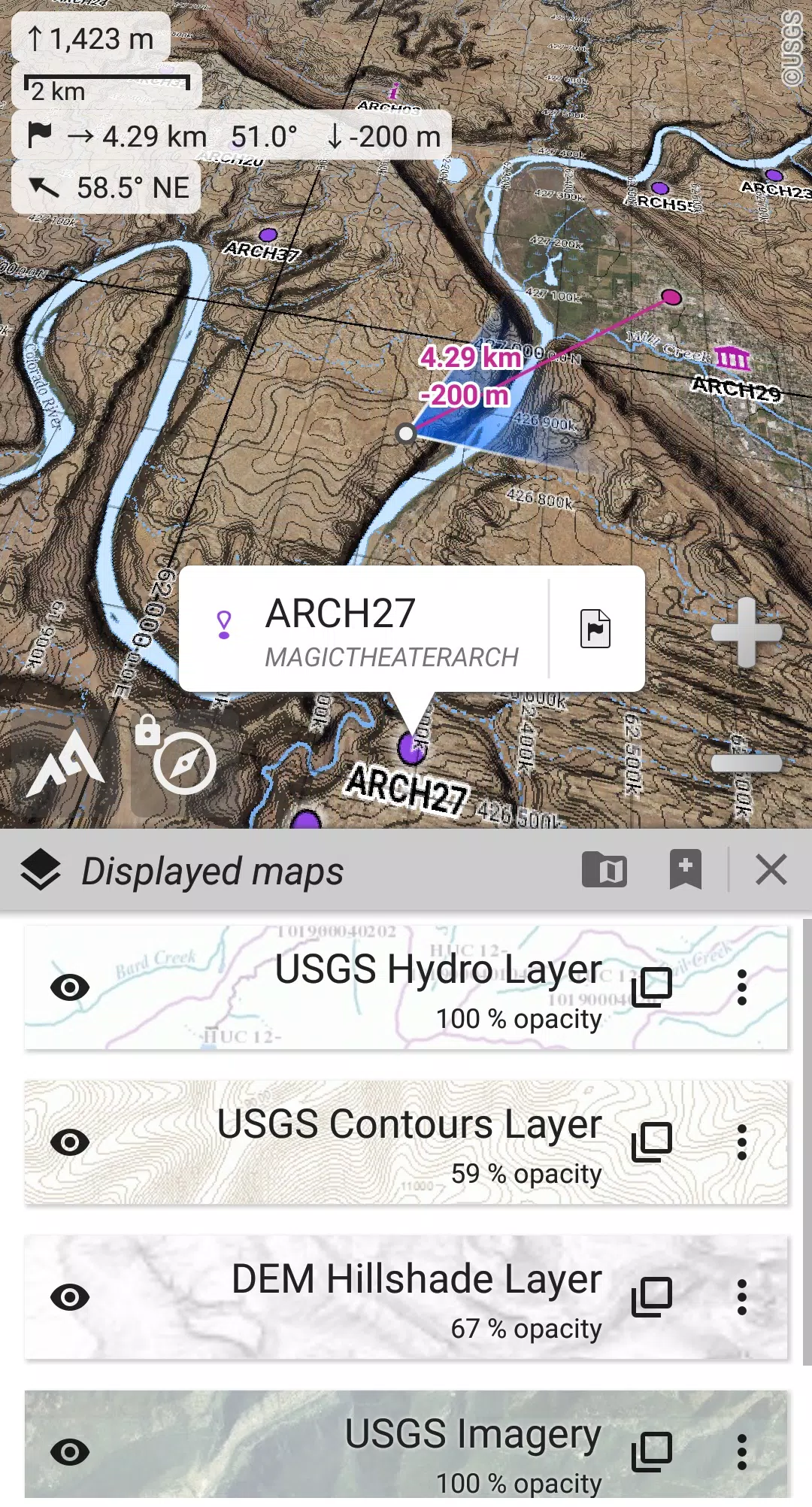
• On-board storage of digital elevation models (1-arcsec SRTM DEM) and support for HGT elevation files (1-arcsec and 3-arcsec resolutions) to display terrain, hillshade, and steep slopes.
• Support for polar maps (Arctic and Antarctic).
• Display multiple maps in layers with customizable opacity, contrast, color, tint, and blending.
★★ Placemarks ★★
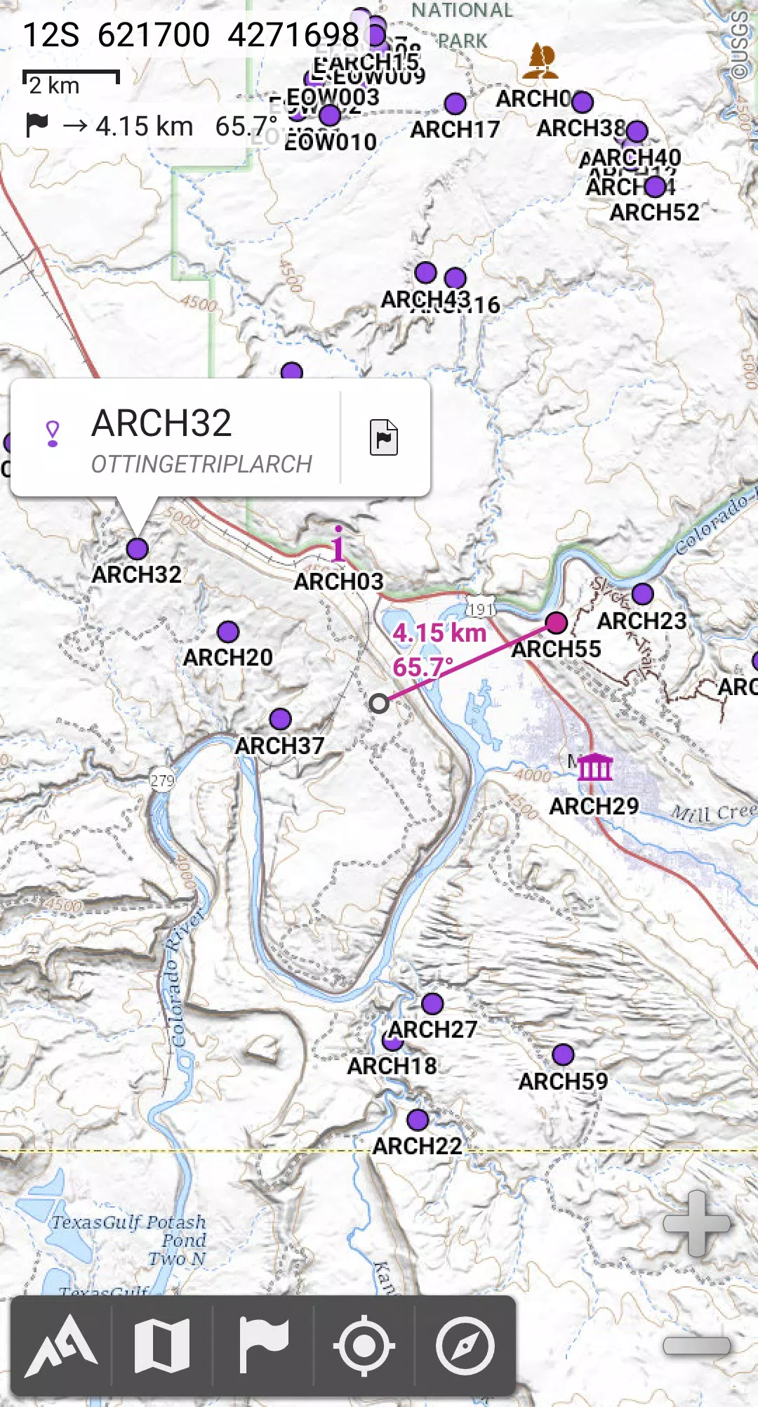
• Create, display, save, and restore an unlimited number of items including waypoints, routes, areas, and tracks.
• Import and export GPX files, Google Earth KML/KMZ files, and CSV/TSV files.
• Import ShapeFile SHP/PRJ/DBF, OziExplorer WPT/PLT, GeoJSON, IGC tracks, Geocaching LOC waypoints, and export AutoCAD DXF files.
• Save and share online locations with other users through Community Placemarks.
• Access detailed information, advanced statistics, and interactive graphics for various items.
• Use the Time Controller to replay time-tagged tracks.
★★ GNSS Position / Orientation ★★
• Real-time on-map geolocation using your device's GNSS receivers (GPS/Glonass/Galileo/…) or network.
• Map orientation, compass, and target finder features.
• Built-in GNSS/Barometric track recorder capable of long tracking, running in a separate, lightweight process, with battery level and network strength recording.
• Proximity and leave path alerts.
• Barometer support for compatible devices.
★★ Additional Features ★★
• Choose from metric, imperial, nautical, and hybrid distance units.
• Use latitude/longitude and various grid coordinate formats (WGS, UTM, MGRS, USNG, OSGB, SK42, Lambert, QTH, etc.) with on-map grid displays.
• Import hundreds of coordinate formats from https://www.spatialreference.org.
• ...
What's New in Version 2.3.8d
Last updated on Aug 14, 2024
2.3.8b/c/d
• New setting to customize the display style and side of the menu bar.
• Enhanced compatibility with recent Android versions.
• Improved backup and restore functionality.
• Updated default URL for sharing coordinates as text.
• Option to set the application's "Media" folder as the default for placemarks, icons, pictures, and file-based maps.
• Added Croatian and Persian language support.
• Various improvements and bug fixes.
Screenshot
Reviews
Apps like AlpineQuest Explorer Lite