
Application Description
The RIWA Karten App: A Mobile GIS Solution for Field Workers
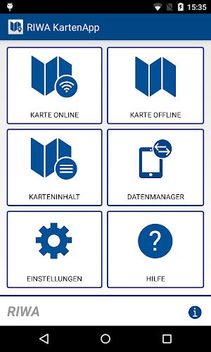
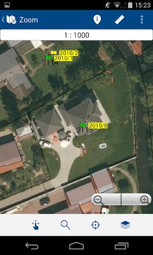
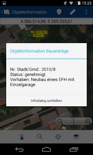
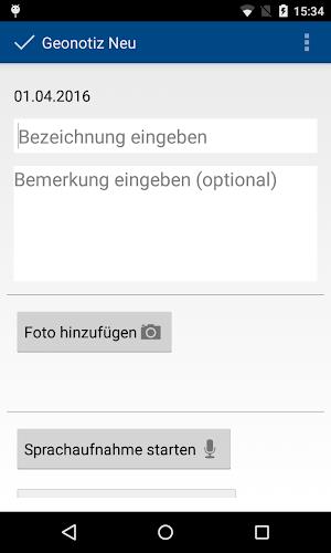
The RIWA Karten mobile application is designed for RIWAGIS-Zentrum users, particularly field personnel. It provides on-the-go access to personal geobase and geospatial data, including associated object information, displayed on an interactive map. This eliminates the need for paper maps by enabling the creation of custom geonotes and survey data directly within the app.
Key features include:
- Offline/Online Functionality: Work seamlessly online or offline; offline data syncs with the RIWAGIS server when a connection is available.
- Comprehensive Mapping: Access and view geospatial data (e.g., trees, canals, pipes) from the RIWA GIS center on a mobile map.
- Advanced Features: Utilize measurement tools, robust search capabilities, customizable layers, and GPS location tracking.
- Modular Design: The app's modular structure ensures a stable and scalable platform for users.
- Intuitive Interface: Enjoy a user-friendly design compatible with various screen resolutions.
The RIWA Karten App streamlines fieldwork by providing a comprehensive and user-friendly GIS solution. Its offline capabilities, combined with powerful search functions and data management tools, empower field workers to improve efficiency and accuracy.
For more information or to request a demo, contact RIWA GmbH.
Screenshot
Reviews
Apps like RIWA KartenApp


Trending apps


Top News


Latest Apps


Latest Articles